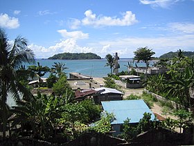
Catanduanes
lalawigan ning Filipinas
Ing Catanduanes metung yang pulung lalawigan ning Filipinas a atiu king Labuad Bicol king Luzon. Ing kayang balen tungku ya pin ing Virac at ing lalawigan atiu king aslagan ning Camarines Sur sumangid Maqueda Channel. Agpang keng 1 Mayu 2020 ning sensus, atin yang populasyun a 271,879 a katau kareng 53,482 a pamimalemale.
Catanduanes | |
|---|---|
 | |
 Mapa ning Labuad Bicol ampong Catanduanes ilage | |
 | |
| Puuk: 13°50'N, 124°15'E | |
| Bansa | Filipinas |
| Labuad | Labuad Bicol (Rehiyong V) |
| Tuknangan | Lalawigan |
| Mitatag | Setyembri 26, 1945 |
| Kapitolyo | Virac |
| Pamamahala | |
| • Lider | Joseph Cua |
| Sukad | |
| • Kabilugan | 1,492.16 km2 (576.13 sq mi) |
| Populasyun (Sensu ning 1 Mayu 2020) | |
| • Kabilugan | 271,879 |
| • Densidad | 180/km2 (470/sq mi) |
| • Pamimalemale | 53,482 |
| IDD : area code | +63 (0)52 |
| Uryan | pangatlu yang klasing lalawigan |
| Panakitan (₱) | ₱1,021,662,652.20494,306,104.04563,212,274.48613,392,009.24707,235,339.65894,788,824.18828,555,283.41879,182,550.62945,695,902.561,157,598,958.761,431,837,062.06 (2020) |
| Amanu | Southern Catanduanes Bikol Pandan Bikol Central Bikol |
| Websayt | catanduanes.gov.ph |
Geografia
mag-editPolitika
mag-editIng Catanduanes atin yang 11 balen.
Balen
mag-edit
|
Demograpiku
mag-edit| Taun | Pop. | ±% p.a. |
|---|---|---|
| 1903 | 39,410 | — |
| 1918 | 63,530 | +3.23% |
| 1939 | 98,545 | +2.11% |
| 1948 | 112,121 | +1.44% |
| 1960 | 156,329 | +2.81% |
| 1970 | 162,302 | +0.38% |
| 1975 | 172,780 | +1.26% |
| 1980 | 175,247 | +0.28% |
| 1990 | 187,000 | +0.65% |
| 1995 | 202,464 | +1.50% |
| 2000 | 215,356 | +1.33% |
| 2007 | 232,757 | +1.08% |
| 2010 | 246,300 | +2.08% |
| 2015 | 260,964 | +1.11% |
| 2020 | 271,879 | +0.81% |
| Sanggunian: Philippine Statistics Authority[1][2][3][4] | ||
Panibatan
mag-edit- ↑ Census of Population (2015). "Total Population by Province, City, Municipality and Barangay". Total Population by Province, City, Municipality and Barangay. PSA.
- ↑ Census of Population and Housing (2010). "Total Population by Province, City, Municipality and Barangay". Total Population by Province, City, Municipality and Barangay. NSO.
- ↑ Censuses of Population (1903–2007). "Table 1. Population Enumerated in Various Censuses by Province/Highly Urbanized City: 1903 to 2007". Table 1. Population Enumerated in Various Censuses by Province/Highly Urbanized City: 1903 to 2007. NSO. https://archive.org/download/PhilippinesCensusofPopulationLGUs19032007/Region%205%20Bicol%20Region%20Philippines%20Census%20of%20Population%201903%20-%202007.xls.
- ↑ Province of Catanduanes. Municipality Population Data. Local Water Utilities Administration Research Division. Retrieved on [[Disiembri 17, 2016]].
Suglung Palwal
mag-edit- PhilAtlas.com
- Philippine Standard Geographic Code
- Local Governance Performance Management System
- Official website of the Provincial Government of Catanduanes
- Catanduanes A Pearl In The Pacific
| Labuad at Lalawigan ning Luzon | |
| Labuad Ilocos: | Ilocos Norte | Ilocos Sur | La Union | Pangasinan |
| Saug Cagayan: | Batanes | Cagayan | Isabela | Nueva Vizcaya | Quirino |
| Kalibudtarang Luzon: | Aurora | Bataan | Bulacan | Nueva Ecija | Pampanga | Tarlac | Zambales |
| CALABARZON: | Batangas | Cavite | Laguna | Quezon | Rizal |
| MIMAROPA: | Marinduque | Occidental Mindoro | Oriental Mindoro | Palawan | Romblon |
| Labuad Bicol: | Albay | Camarines Norte | Camarines Sur | Catanduanes | Masbate | Sorsogon |
| Cordillera Adm. Region: | Abra | Apayao | Benguet | Ifugao | Kalinga | Mountain Province |
| Metro Manila: | Alang lalawigan |

