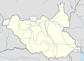
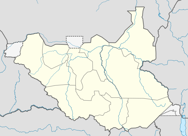
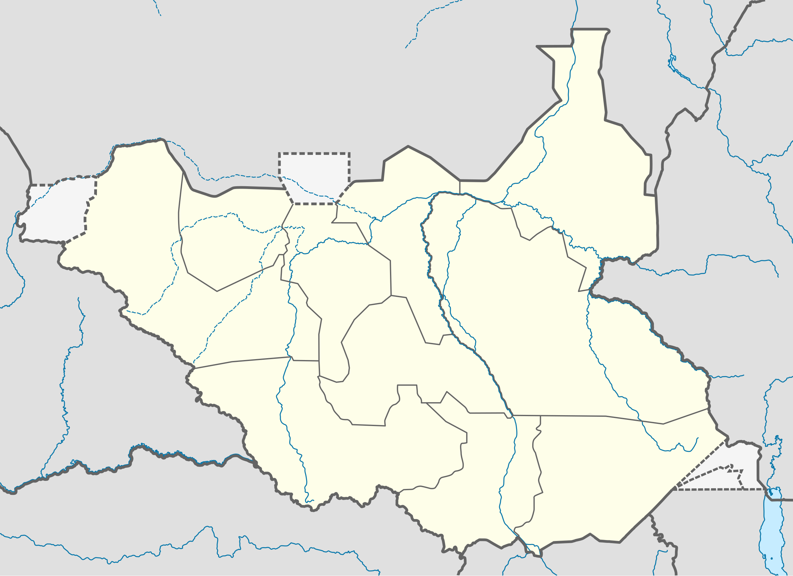
File:South Sudan location map.svg

Ing minunang simpan (file) (SVG file, masasabing 1,561 × 1,133 pixels, dagul ning simpan: 205 KB)
Sampulung (summary)
| Description |
Deutsch: Positionskarte vom Südsudan
Quadratische Plattkarte, N-S-Streckung 101 %. Geographische Begrenzung der Karte:
English: Location map of South Sudan
Equirectangular projection, N/S stretching 101 %. Geographic limits of the map:
|
|
| Petsa | ||
| Pikuanan |
Own work, using
|
|
| Maki-akda | NordNordWest | |
| Permission (Reusing this file) |
This file is licensed under the Creative Commons Attribution-Share Alike 3.0 Germany license.
 This file is licensed under the Creative Commons Attribution-Share Alike 3.0 Unported license.
|
|
| Other versions |
Derivative works of this file: File:South Sudan location green map.svg |


|
This map has been made or improved in the German Kartenwerkstatt (Map Lab). You can propose maps to improve as well.
|
Amlat ning simpan (File history)
Mag-click kang petsa/oras ba meng akit ing itsura ning simpan aniang panaun a ita.
| Petsa/Oras | Thumbnail | Sukad | Talagamit | Komentu/Puna | |
|---|---|---|---|---|---|
| salukuyan | 08:21, 18 Agostu 2011 | | 1,561 × 1,133 (205 KB) | Spesh531 | I am reverting and fixing all of the templates ot the best of my ability, I can need some help |
| 07:53, 18 Agostu 2011 |  | 1,500 × 1,133 (171 KB) | NordNordWest | you cannot change the area that is shown without adjusting all templates in which this map is used | |
| 23:20, 17 Agostu 2011 |  | 1,561 × 1,133 (205 KB) | Spesh531 | adding a disputed territory | |
| 11:42, 18 Juliu 2011 |  | 1,500 × 1,133 (171 KB) | NordNordWest | corr | |
| 12:04, 8 Juliu 2011 |  | 1,500 × 1,133 (172 KB) | NordNordWest | upd | |
| 14:23, 18 Pebreru 2011 |  | 1,500 × 1,133 (178 KB) | NordNordWest | =={{int:filedesc}}== {{Information |Description= {{de|Positionskarte vom Südsudan}} Quadratische Plattkarte, N-S-Streckung 101 %. Geographische Begrenzung der Karte: * N: 12.7° N * S: 3.2° N * W: 23.7° O * O: 36.4° O {{en|Location m |
↓Suglung kareng simpan (''file links'')
Ing tutuking page links kaniting simpan (file):
Global file usage
The following other wikis use this file:
- Usage on af.wikipedia.org
- Usage on ar.wikipedia.org
- Usage on bn.wikipedia.org
- Usage on ckb.wikipedia.org
- Usage on da.wikipedia.org
- Usage on de.wikipedia.org
- Usage on en.wikipedia.org
- Usage on eo.wikipedia.org
- Usage on es.wikipedia.org
- Usage on eu.wikipedia.org
- Usage on fa.wikipedia.org
- Usage on frr.wikipedia.org
- Usage on gl.wikipedia.org
- Usage on hy.wikipedia.org
- Usage on id.wikipedia.org
- Usage on incubator.wikimedia.org
- Usage on it.wikipedia.org
View more global usage of this file.