File:Mount mantalingahan palawan.jpg
Ala nang mas malino pa.
Mount_mantalingahan_palawan.jpg (640 × 427 pixel, sukad ning simpan: 302 KB, MIME type: image/jpeg)
Sampulung (summary)
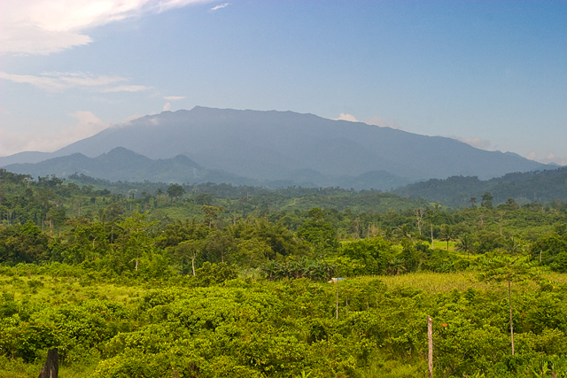
| Description | Mount Mantalingahan, an ultramafic peak of 2085 m, photographed from the barangay of Ransang, Rizal municipality, Philippines. The summit ridge is two to three days distant on foot, and one and a half days on the downward return journey (Alastair Robinson, July 2007). | ||
| Petsa | 24 Nobyembri 2007 (original upload date) | ||
| Pikuanan | Transfered from en.wikipedia | ||
| Maki-akda | Original uploader was Alastair Robinson at en.wikipedia | ||
| Permission (Reusing this file) |
|
Pamamie lisensia
Alastair Robinson at en.wikipedia, the copyright holder of this work, hereby publishes it under the following license:
This file is licensed under the Creative Commons Attribution 3.0 Unported license.
Attribution: Alastair Robinson at en.wikipedia
- You are free:
- to share – to copy, distribute and transmit the work
- to remix – to adapt the work
- Under the following conditions:
- attribution – You must give appropriate credit, provide a link to the license, and indicate if changes were made. You may do so in any reasonable manner, but not in any way that suggests the licensor endorses you or your use.
Original upload log
The original description page is/was here. All following user names refer to en.wikipedia.
- 2007-11-24 09:52 Alastair Robinson 640×427 (302 KB) Mount Mantalingahan, an [[ultramafic]] peak of 2085 [[metre|m]], photographed from the township of Ransang, [[Rizal, Palawan|Rizal Province]], [[Philippines]]. The summit ridge is two to three days distant on foot, and one and a half days on the downward return journey (Alastair Robinson, July 2007).
Amlat ning simpan (File history)
Mag-click kang petsa/oras ba meng akit ing itsura ning simpan aniang panaun a ita.
| Petsa/Oras | Thumbnail | Sukad | Talagamit | Komentu/Puna | |
|---|---|---|---|---|---|
| salukuyan | 15:49, 6 Juniu 2008 | | 640 × 427 (302 KB) | Ch.Andrew | {{Information |Description= Mount Mantalingahan, an ultramafic peak of 2085 m, photographed from the township of Ransang, Rizal Province, Philippines. The summit ridge is two to three days distant on foot, and one and |
↓Suglung kareng simpan (''file links'')
Ing tutuking page links kaniting simpan (file):
Global file usage
The following other wikis use this file:
- Usage on af.wikipedia.org
- Usage on ar.wikipedia.org
- Usage on bcl.wikipedia.org
- Usage on cbk-zam.wikipedia.org
- Usage on ceb.wikipedia.org
- Usage on de.wikipedia.org
- Usage on en.wikipedia.org
- Usage on es.wikipedia.org
- Usage on fa.wikipedia.org
- Usage on fr.wikipedia.org
- Usage on hu.wikipedia.org
- Usage on ilo.wikipedia.org
- Usage on it.wikipedia.org
- Usage on ka.wikipedia.org
- Usage on lld.wikipedia.org
- Usage on ms.wikipedia.org
- Usage on nl.wikipedia.org
- Usage on no.wikipedia.org
- Usage on pag.wikipedia.org
- Usage on pt.wikipedia.org
- Usage on ro.wikipedia.org
- Usage on ru.wikipedia.org
- Usage on sv.wikipedia.org
- Usage on th.wikipedia.org
View more global usage of this file.