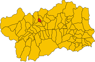
File:Map of comune of Allein (region Aosta Valley, Italy).svg

Size of this PNG preview of this SVG file: 522 × 343 pixels. Other resolutions: 320 × 210 pixels | 640 × 421 pixels | 1,024 × 673 pixels | 1,280 × 841 pixels | 2,560 × 1,682 pixels.
Ing minunang simpan (file) (SVG file, masasabing 522 × 343 pixels, dagul ning simpan: 138 KB)
.svg)
Sampulung (summary)
| Description | |
| Petsa | |
| Pikuanan | Own work |
| Maki-akda | Vonvikken |
| SVG genesis | This W3C-invalid locator map was created with Inkscape. |
Pamamie lisensia
| I, the copyright holder of this work, release this work into the public domain. This applies worldwide. In some countries this may not be legally possible; if so: I grant anyone the right to use this work for any purpose, without any conditions, unless such conditions are required by law. |
Amlat ning simpan (File history)
Mag-click kang petsa/oras ba meng akit ing itsura ning simpan aniang panaun a ita.
| Petsa/Oras | Thumbnail | Sukad | Talagamit | Komentu/Puna | |
|---|---|---|---|---|---|
| salukuyan | 12:50, 7 Juniu 2010 | | 522 × 343 (138 KB) | File Upload Bot (Vonvikken) | == {{int:filedesc}} == {{Information |Description={{DescrMapComuneItaly|Allein|||AO}} |Source={{own}} |Author=Vonvikken |Date=2010-06-07 |Permission= }} {{inkscape}} == {{int:license}} == {{PD-self}} |
↓Suglung kareng simpan (''file links'')
Ing tutuking page links kaniting simpan (file):
Global file usage
The following other wikis use this file:
- Usage on als.wikipedia.org
- Usage on bg.wikipedia.org
- Usage on ca.wikipedia.org
- Usage on ceb.wikipedia.org
- Usage on en.wikipedia.org
- Usage on es.wikipedia.org
- Usage on et.wikipedia.org
- Usage on fr.wikipedia.org
- Usage on hu.wikipedia.org
- Usage on id.wikipedia.org
- Usage on it.wikipedia.org
- Usage on ja.wikipedia.org
- Usage on la.wikipedia.org
- Usage on lij.wikipedia.org
- Usage on ms.wikipedia.org
- Usage on nl.wikipedia.org
- Usage on ro.wikipedia.org
- Usage on sco.wikipedia.org
- Usage on sv.wikipedia.org
- Usage on tl.wikipedia.org
.svg)