File:Map of California highlighting Butte County.svg

Size of this PNG preview of this SVG file: 512 × 587 pixels. Other resolutions: 209 × 240 pixels | 419 × 480 pixels | 670 × 768 pixels | 893 × 1,024 pixels | 1,786 × 2,048 pixels.
Ing minunang simpan (file) (SVG file, masasabing 512 × 587 pixels, dagul ning simpan: 227 KB)
Sampulung (summary)
| Description |
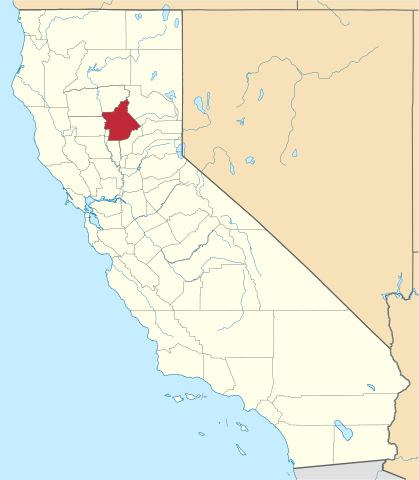
English: This is a locator map showing Butte County in California. For more information, see Commons:United States county locator maps. |
| Petsa | |
| Pikuanan |
Own work: English: The maps use data from nationalatlas.gov, specifically countyp020.tar.gz on the Raw Data Download page. The maps also use state outline data from statesp020.tar.gz. The Florida maps use hydrogm020.tar.gz to display Lake Okeechobee. |
| Maki-akda | David Benbennick |
Pamamie lisensia
| I, the copyright holder of this work, release this work into the public domain. This applies worldwide. In some countries this may not be legally possible; if so: I grant anyone the right to use this work for any purpose, without any conditions, unless such conditions are required by law. |
Amlat ning simpan (File history)
Mag-click kang petsa/oras ba meng akit ing itsura ning simpan aniang panaun a ita.
| Petsa/Oras | Thumbnail | Sukad | Talagamit | Komentu/Puna | |
|---|---|---|---|---|---|
| salukuyan | 18:58, 2 Setyembri 2019 | | 512 × 587 (227 KB) | Fluffy89502 | newer map |
| 10:25, 12 Pebreru 2006 |  | 9,164 × 10,536 (229 KB) | David Benbennick | {{subst:User:Dbenbenn/clm|county=Butte County|state=California}} |
↓Suglung kareng simpan (''file links'')
Ing tutuking page links kaniting simpan (file):
Global file usage
The following other wikis use this file:
- Usage on ar.wikipedia.org
- مقاطعة بوت (كاليفورنيا)
- تشيكو (كاليفورنيا)
- بيغغس (كاليفورنيا)
- غريدلي (كاليفورنيا)
- أوروفيل (كاليفورنيا)
- باراديس (كاليفورنيا)
- مدينة أوريغون
- ديسابلا
- سنترفيل (كاليفورنيا)
- فيذر فولز
- إنسكيب (كاليفورنيا)
- مايارو
- ميريماك
- برش كريك
- شرق بيجز
- دايتون (كاليفورنيا)
- باوكا
- كانا (كاليفورنيا)
- شرق جريدلي
- إسكيني
- هوك رابين
- هيلتاون
- هولفوتو
- هورلتون
- أشعيا
- جونزفيل
- كولايفي
- لاس بلوماس
- لافا بيدز
- لومو
- لوفلوك (كاليفورنيا)
- لمبكين
- موزلي
- نيلسون بار
- أولد فوربستون
- أولولوبا
- أوتاكي (كاليفورنيا)
- باكي (كاليفورنيا)
- زمارون
- ريتشاردسون سبرينغز
- ريتشلاند (كاليفورنيا)
- روبنسونز كورنر
- سوننيسلوب
- تادويكو
- تايكوس
- توادتاون
- توتوما
- تسوكا
- ياويكو
- دياموندفيل
View more global usage of this file.