File:Kazakhstan location map.svg

Ing minunang simpan (file) (SVG file, masasabing 1,984 × 1,134 pixels, dagul ning simpan: 634 KB)
Sampulung (summary)
| Description |
Deutsch: Positionskarte von Kasachstan
Quadratische Plattkarte, N-S-Streckung 150 %. Geographische Begrenzung der Karte:
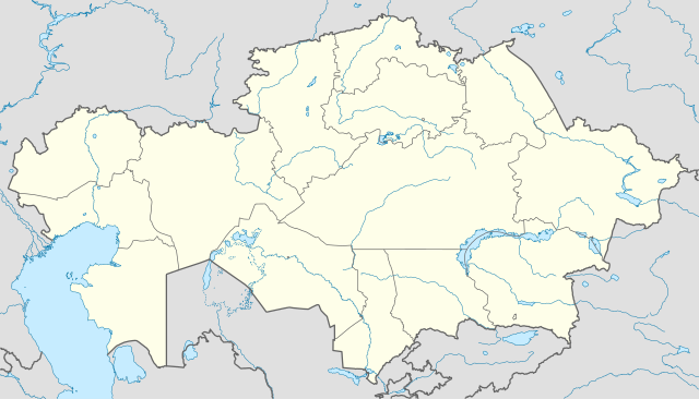
English: Location map of Kazakhstan
Equirectangular projection, N/S stretching 150 %. Geographic limits of the map:
|
|
| Petsa | ||
| Pikuanan |
Own work, using
|
|
| Maki-akda | NordNordWest | |
| Permission (Reusing this file) |
This file is licensed under the Creative Commons Attribution-Share Alike 3.0 Germany license.
 This file is licensed under the Creative Commons Attribution-Share Alike 3.0 Germany license.
|


|
This map has been made or improved in the German Kartenwerkstatt (Map Lab). You can propose maps to improve as well.
|
Amlat ning simpan (File history)
Mag-click kang petsa/oras ba meng akit ing itsura ning simpan aniang panaun a ita.
| Petsa/Oras | Thumbnail | Sukad | Talagamit | Komentu/Puna | |
|---|---|---|---|---|---|
| salukuyan | 18:48, 1 Agostu 2010 | | 1,984 × 1,134 (634 KB) | NordNordWest | upd |
| 19:15, 27 Nobyembri 2009 |  | 1,985 × 1,134 (949 KB) | NordNordWest | c | |
| 12:42, 24 Nobyembri 2009 |  | 1,984 × 1,134 (942 KB) | NordNordWest | c | |
| 12:38, 24 Nobyembri 2009 |  | 1,985 × 1,134 (941 KB) | NordNordWest | ||
| 18:41, 23 Nobyembri 2009 |  | 1,985 × 1,134 (516 KB) | NordNordWest | =={{int:filedesc}}== {{Information |Description= {{de|Positionskarte von Kasachstan, '''Vorversion'''}} Quadratische Plattkarte, N-S-Streckung 150 %. Geographische Begrenzung der Karte: * N: 56° N * S: 40° N * W: 46° O * O: 88° O {{ |
↓Suglung kareng simpan (''file links'')
Alang bulung a pakasuglung king simpan (file) a ini.
Global file usage
The following other wikis use this file:
- Usage on av.wikipedia.org
- Usage on bg.wikinews.org
- Usage on de.wikipedia.org
- Usage on es.wikipedia.org
- Usage on fr.wikipedia.org
- Usage on incubator.wikimedia.org
- Usage on kaa.wikipedia.org
- Usage on lv.wikipedia.org
- Usage on mt.wikipedia.org
- Usage on pt.wikipedia.org
- Usage on rue.wikipedia.org
- Usage on ru.wikipedia.org
- Usage on sk.wikipedia.org