File:KanagawaMapCurrent.png
Size of this preview: 800 × 500 pixels. Other resolutions: 320 × 200 pixels | 640 × 400 pixels | 1,024 × 640 pixels | 1,281 × 801 pixels.
Ing minunang simpan (file) (1,281 × 801 pixel, sukad ning simpan: 134 KB, MIME type: image/png)
Sampulung (summary)
| Description |
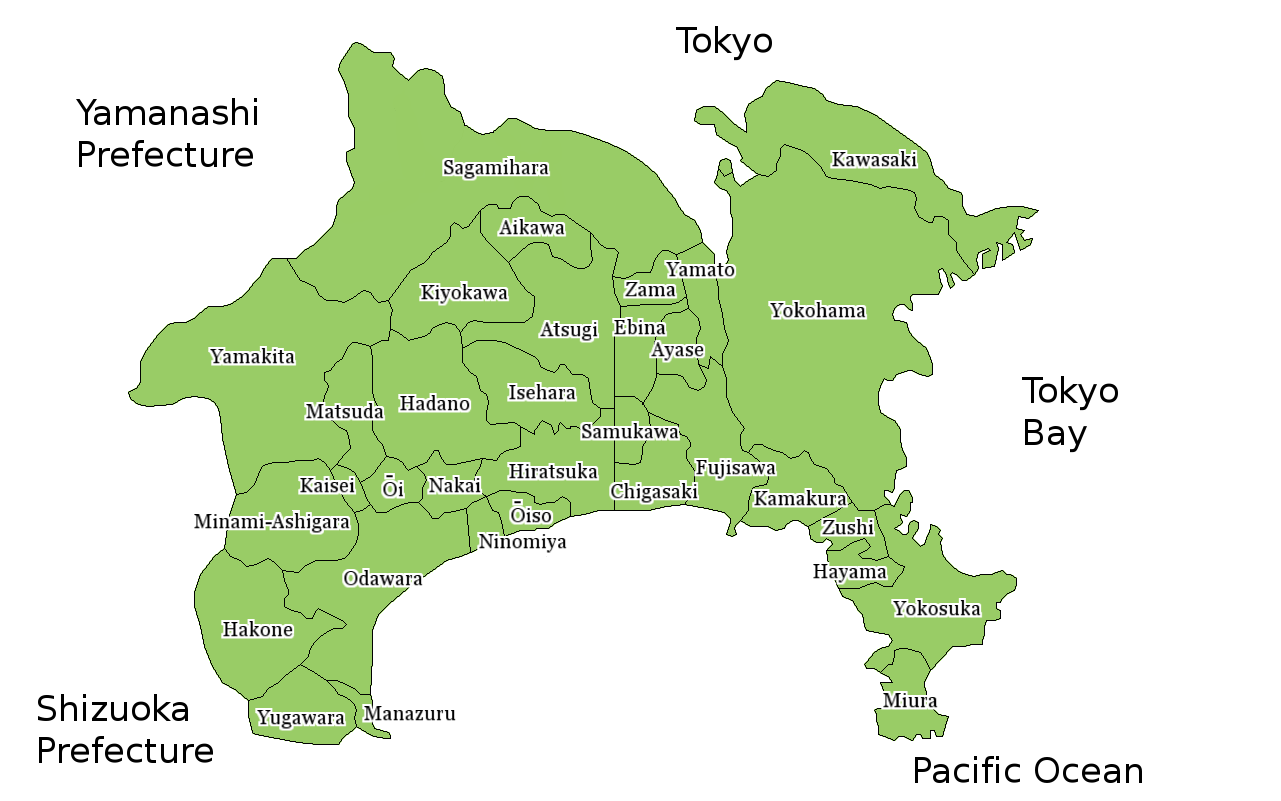
Map of Kanagawa Prefecture, Japan. Thanks to Aoki Shigenobu and [1]. Colors from Image:TokyoMapCurrent.png by User:Fg2. |
| Petsa | 18 Hulyu 2006 (original upload date) |
| Pikuanan | No machine-readable source provided. Own work assumed (based on copyright claims). |
| Maki-akda | No machine-readable author provided. Akanemoto~commonswiki assumed (based on copyright claims). |
Pamamie lisensia
| I, the copyright holder of this work, release this work into the public domain. This applies worldwide. In some countries this may not be legally possible; if so: I grant anyone the right to use this work for any purpose, without any conditions, unless such conditions are required by law. |
Amlat ning simpan (File history)
Mag-click kang petsa/oras ba meng akit ing itsura ning simpan aniang panaun a ita.
| Petsa/Oras | Thumbnail | Sukad | Talagamit | Komentu/Puna | |
|---|---|---|---|---|---|
| salukuyan | 15:26, 25 Marsu 2010 | | 1,281 × 801 (134 KB) | MIsogi | update |
| 14:10, 10 Juniu 2007 |  | 1,281 × 801 (40 KB) | Alberth2 | Sagamihara City has merged some towns and villages. | |
| 11:19, 18 Juliu 2006 |  | 1,281 × 801 (38 KB) | Akanemoto~commonswiki | Map of Kanagawa Prefecture, Japan. Thanks to Aoki Shigenobu and [http://aoki2.si.gunma-u.ac.jp/map/map.html]. Colors from Image:TokyoMapCurrent.png by User:Fg2. Category:Maps of Kanagawa prefecture Category:Maps in English |
↓Suglung kareng simpan (''file links'')
Ing tutuking page links kaniting simpan (file):
Global file usage
The following other wikis use this file:
- Usage on ast.wikipedia.org
- Usage on az.wikipedia.org
- Usage on be.wikipedia.org
- Usage on ckb.wikipedia.org
- Usage on cs.wikipedia.org
- Usage on es.wikipedia.org
- Usage on eu.wikipedia.org
- Usage on fa.wikipedia.org
- Usage on fi.wikipedia.org
- Usage on lt.wikipedia.org
- Usage on ms.wikipedia.org
- Usage on no.wikipedia.org
- Usage on pl.wikipedia.org
- Usage on ru.wikipedia.org
- Usage on vi.wikipedia.org
- Usage on www.wikidata.org