File:Cambodia-Kampong Cham.png

Size of this preview: 644 × 599 pixels. Other resolutions: 258 × 240 pixels | 516 × 480 pixels | 664 × 618 pixels.
Ing minunang simpan (file) (664 × 618 pixel, sukad ning simpan: 149 KB, MIME type: image/png)

|
This locator map image could be re-created using vector graphics as an SVG file. This has several advantages; see Commons:Media for cleanup for more information. If an SVG form of this image is available, please upload it and afterwards replace this template with
{{vector version available|new image name}}.
It is recommended to name the SVG file “Cambodia-Kampong Cham.svg”—then the template Vector version available (or Vva) does not need the new image name parameter. |
Sampulung (summary)
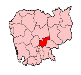
Map of Cambodia showing Kampong Cham province.
Made by User:Golbez based on a map by Morwen on en.wikipedia.org.
Pamamie lisensia

|
Permission is granted to copy, distribute and/or modify this document under the terms of the GNU Free Documentation License, Version 1.2 or any later version published by the Free Software Foundation; with no Invariant Sections, no Front-Cover Texts, and no Back-Cover Texts. A copy of the license is included in the section entitled GNU Free Documentation License. |
| This file is licensed under the Creative Commons Attribution-Share Alike 3.0 Unported license. | ||
| ||
| This licensing tag was added to this file as part of the GFDL licensing update. |
Amlat ning simpan (File history)
Mag-click kang petsa/oras ba meng akit ing itsura ning simpan aniang panaun a ita.
| Petsa/Oras | Thumbnail | Sukad | Talagamit | Komentu/Puna | |
|---|---|---|---|---|---|
| salukuyan | 14:32, 10 Disyembri 2014 | | 664 × 618 (149 KB) | Nisetpdajsankha | the province was separated into Kampong Cham and Tboung Khmom |
| 08:54, 20 Disyembri 2005 |  | 200 × 161 (6 KB) | Golbez | Map of Cambodia showing Kampong Cham province. Made by User:Golbez based on a map by Morwen on en.wikipedia.org. Category:Maps of Cambodia |
↓Suglung kareng simpan (''file links'')
Ing tutuking page links kaniting simpan (file):
Global file usage
The following other wikis use this file:
- Usage on ca.wikipedia.org
- Usage on km.wikipedia.org
- Usage on new.wikipedia.org
- Usage on pnb.wikipedia.org
- Usage on vi.wikipedia.org
- Usage on war.wikipedia.org