File:Ancient Germania - New York, Harper and Brothers 1849.jpg
Ing minunang simpan (file) (1,964 × 1,619 pixel, sukad ning simpan: 841 KB, MIME type: image/jpeg)
Sampulung (summary)
| Description |
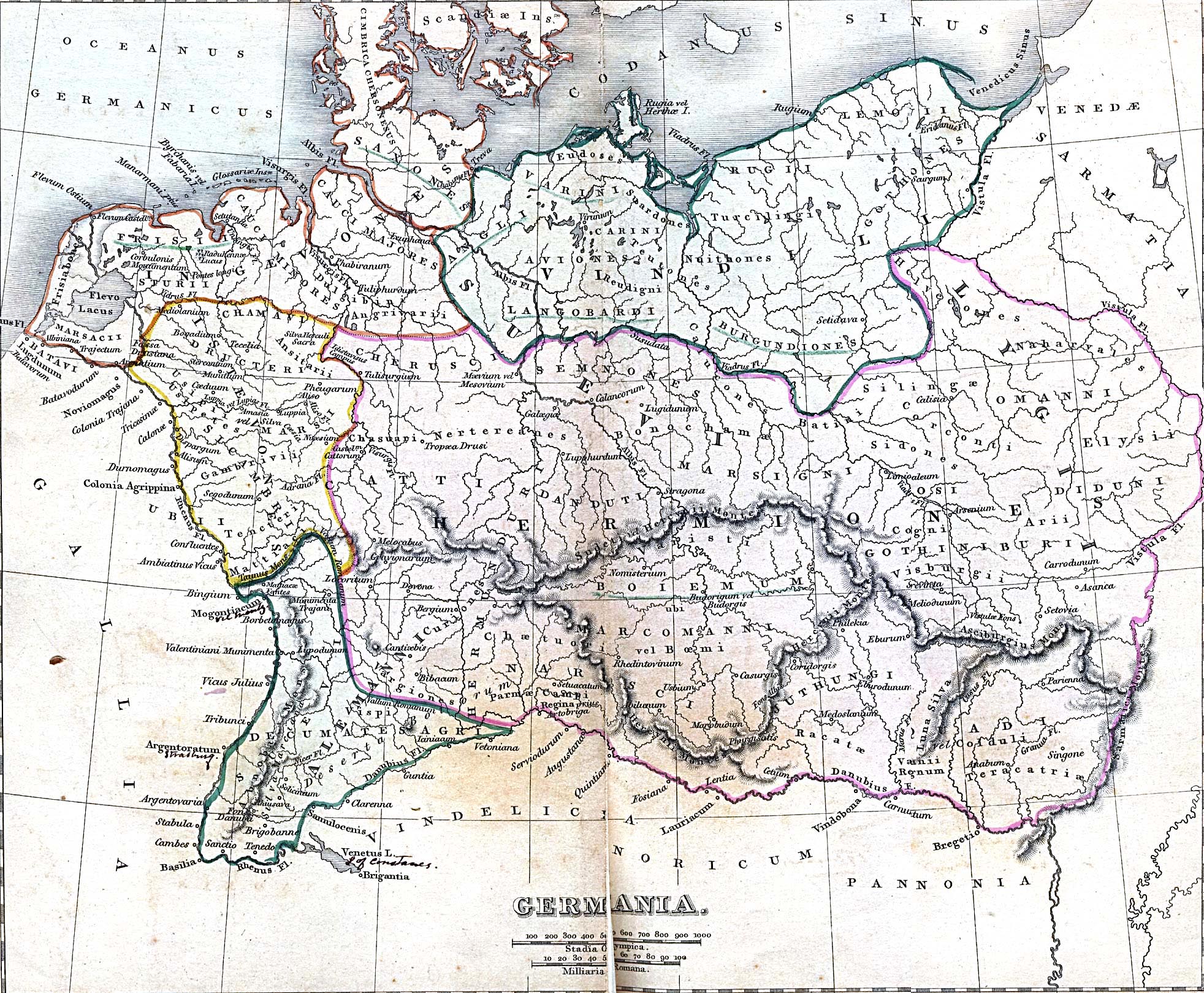
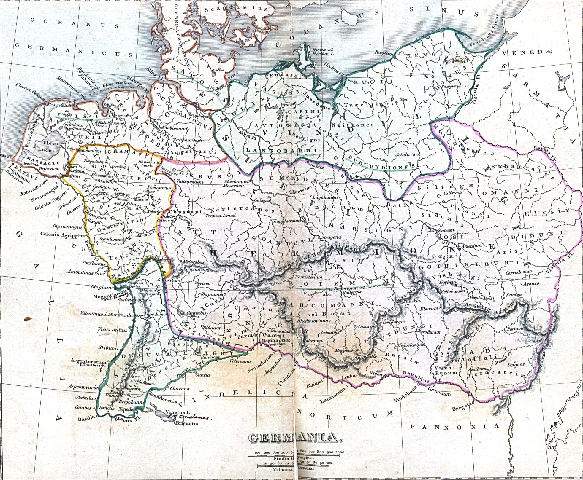
English: Ancient Germania From A Classical Atlas of Ancient Geography by Alexander G. Findlay. New York, Harper and Brothers, 1849. |
| Petsa | |
| Pikuanan | http://www.lib.utexas.edu/maps/historical/, description: ./history_europe.html, map: ./ancient_germania.jpg |
| Maki-akda | Alexander G. Findlay |
| Permission (Reusing this file) |
PD-old |
| Comment | By admission of the author himself, the map does not represent a specific era, but rather a very long period. [1] |
Pamamie lisensia
|
This work is in the public domain in its country of origin and other countries and areas where the copyright term is the author's life plus 70 years or fewer.
| |
| This file has been identified as being free of known restrictions under copyright law, including all related and neighboring rights. | |
Amlat ning simpan (File history)
Mag-click kang petsa/oras ba meng akit ing itsura ning simpan aniang panaun a ita.
| Petsa/Oras | Thumbnail | Sukad | Talagamit | Komentu/Puna | |
|---|---|---|---|---|---|
| salukuyan | 14:21, 12 Mayu 2005 | | 1,964 × 1,619 (841 KB) | Luestling~commonswiki | Ancient Germania<br>From ''A Classical Atlas of Ancient Geography'' by Alexander G. Findlay. New York, Harper and Brothers, 1849 {{PD}} Category:Historical maps |
↓Suglung kareng simpan (''file links'')
Ing tutuking page links kaniting simpan (file):
Global file usage
The following other wikis use this file:
- Usage on af.wikipedia.org
- Usage on ast.wikipedia.org
- Usage on bg.wikipedia.org
- Usage on br.wikipedia.org
- Usage on ceb.wikipedia.org
- Usage on cs.wikipedia.org
- Usage on da.wikipedia.org
- Usage on de.wikipedia.org
- Germanen
- Waren (Müritz)
- Pommerellen
- Chauken
- Bützow
- Darłowo
- Kalisia
- Germania magna
- Wikipedia:Fotowerkstatt/Archiv 3
- Wikipedia:WikiProjekt Braunschweig/Braunschweigische Geschichte
- Römisch-Germanische Kriege
- Diskussion:Deutsche/Archiv/1
- Benutzer:Thombansen/Artikel in Überarbeitung 1
- Wikipedia:WikiProjekt Germanen/Toponymie
- Loupfourdon
- Benutzer:Methodios/Kalisia
- Usage on de.wiktionary.org
- Usage on en.wikipedia.org
- Usage on en.wiktionary.org
- Usage on eo.wikipedia.org
- Usage on es.wikipedia.org
- Usage on fr.wikipedia.org
View more global usage of this file.