File:HiroshimaMapCurrent.png

Size of this preview: 800 × 563 pixels. Other resolutions: 320 × 225 pixels | 640 × 450 pixels | 1,024 × 720 pixels | 1,281 × 901 pixels.
Ing minunang simpan (file) (1,281 × 901 pixel, sukad ning simpan: 44 KB, MIME type: image/png)
Sampulung (summary)
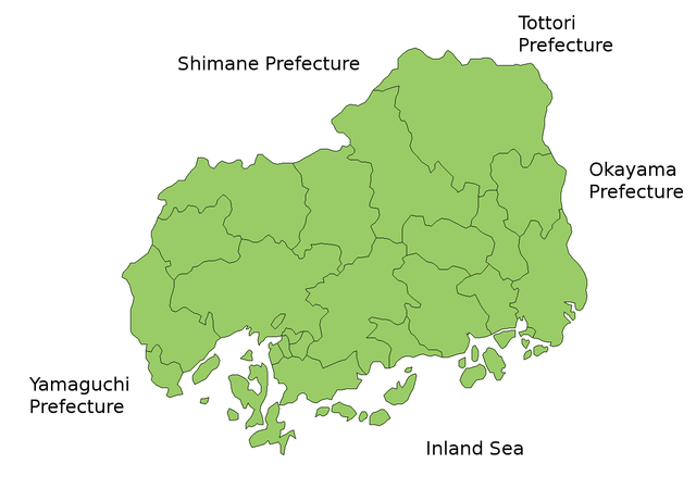
Map of Hiroshima Prefecture, Japan.
Thanks to Aoki Shigenobu and [1]. Colors from Image:TokyoMapCurrent.png by User:Fg2.
Pamamie lisensia

|
Shigenobu AOKI, the copyright holder of this work, allows anyone to use it for any purpose including unrestricted redistribution, commercial use, and modification. |
Amlat ning simpan (File history)
Mag-click kang petsa/oras ba meng akit ing itsura ning simpan aniang panaun a ita.
| Petsa/Oras | Thumbnail | Sukad | Talagamit | Komentu/Puna | |
|---|---|---|---|---|---|
| salukuyan | 23:49, 10 Nobyembri 2010 | | 1,281 × 901 (44 KB) | Alberth2 | Color |
| 23:48, 10 Nobyembri 2010 |  | 1,281 × 901 (44 KB) | Alberth2 | Modified Hiroshima City Edge | |
| 23:48, 10 Nobyembri 2010 |  | 1,281 × 901 (44 KB) | Alberth2 | Modified Hiroshima City Edge | |
| 10:33, 3 Agostu 2006 |  | 1,281 × 901 (43 KB) | Akanemoto~commonswiki | ||
| 00:31, 24 Juliu 2006 |  | 1,281 × 901 (43 KB) | Akanemoto~commonswiki | ||
| 02:37, 22 Juliu 2006 |  | 1,381 × 901 (44 KB) | Akanemoto~commonswiki | ||
| 08:58, 19 Juliu 2006 |  | 1,281 × 901 (44 KB) | Akanemoto~commonswiki | ||
| 10:54, 18 Juliu 2006 |  | 1,281 × 901 (43 KB) | Akanemoto~commonswiki | Map of Hiroshima Prefecture, Japan. Thanks to Aoki Shigenobu and [http://aoki2.si.gunma-u.ac.jp/map/map.html]. Colors from Image:TokyoMapCurrent.png by User:Fg2. Category:Maps of Hiroshima prefecture Category:Maps in English |
↓Suglung kareng simpan (''file links'')
Ing tutuking page links kaniting simpan (file):
Global file usage
The following other wikis use this file:
- Usage on az.wikipedia.org
- Usage on ckb.wikipedia.org
- Usage on cs.wikipedia.org
- Usage on eu.wikipedia.org
- Usage on kaa.wikipedia.org
- Usage on lt.wikipedia.org
- Usage on ms.wikipedia.org
- Usage on no.wikipedia.org
- Usage on pt.wikipedia.org
- Usage on ru.wikipedia.org